Site: Castelló Sobirà de St. Gervàs.
Campaigns: 2020.
Directors: Walter Alegría and Marta Sancho.
Description:
The last archaeological interventions in this important site date back to the 80s of the twentieth century when Dr. José Ignacio Padilla discovered the moat and some habitat areas. Previously, Dr. Manuel Riu had intervened in the church of St. Maria associated with the settlement. Currently, in collaboration with the town council of Gavet, we are resuming the excavations of this interesting site.


At the foot of the castle is the settlement, with an area of about 8 hectares, surrounded by a wall and organized along a street that links the castle with the church of Santa Maria. Its origin dates back to the mid-11th century, a time characterized by the concentration of habitat around the feudal castles within the process known as incastellamento.
The church of Sant Gervàs is located a short distance from the castle in an easterly direction. It was built during the 12th century and renovated in the 14th and 15th centuries when a chapel was added on the north side. It is considered to have been the castral chapel, as opposed to that of Santa Maria, which would have been the parish church associated with the settlement. This fact has given its name to the castle that is currently known as Castell de Sant Gervàs.
In the absence of archaeological confirmation, we place the end of this settlement during the fourteenth century, coinciding with the crisis and decline of feudal society.


Site: Camp dels Moros de la Codina.
Campaigns: 2019 to present.
Directors: Bet Mallofré and Jordi Vallverdú.
Description:
In collaboration with the Centre d’Estudis Lacetans and the town council of Pinell we have resumed excavations at this site where excavations had already been carried out in previous years.


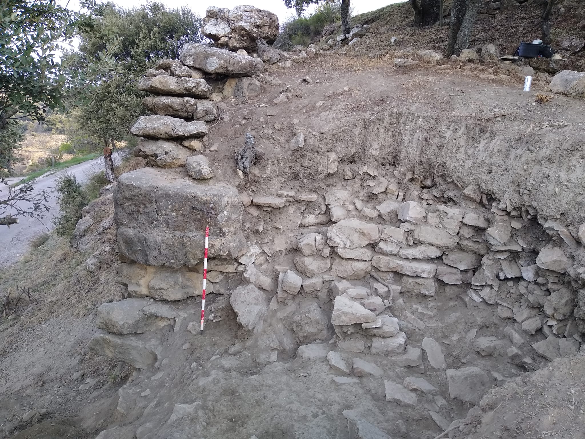
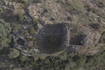
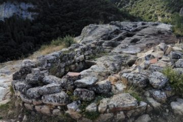
It is a fortified settlement with a castral enclosure located on a rocky spur about 3 m high on which a series of rooms divided by party walls that adapt to the morphology of the terrain are arranged. At a lower level, we have identified a series of buildings in a radial arrangement. The complex is protected by a wall reinforced by a square tower. The archaeological works have not yet provided any evidence of the occupation of this site for the first phases of the medieval period. So far all materials correspond to 13th-14th century amortization levels.

Site: Conca d’Ençà y Castell de Mur.
Campaigns: 2020.
Directors: Xavier Costa.
Descriptions:
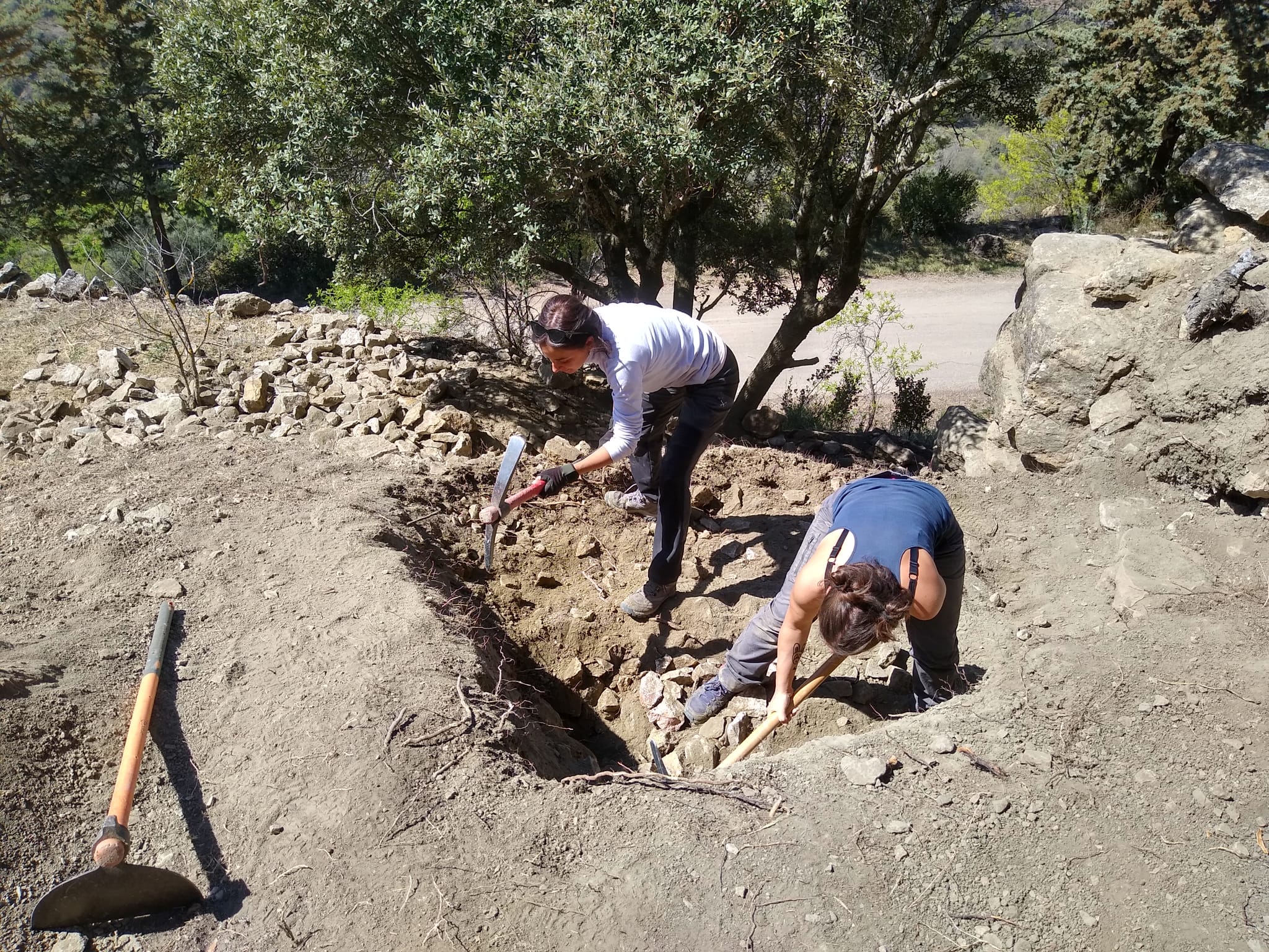
Apart from excavating several sites that offer different models of occupation of the territory and allow to cover, totally or partially, the whole chronological arc prefixed, the Muntanya Viva project wanted to complement its research with some prospecting campaigns that can help us to better understand the occupational reality and the societies that inhabited the Pallars area between the fourth and thirteenth centuries. Specifically, three interventions of different characteristics have been carried out.

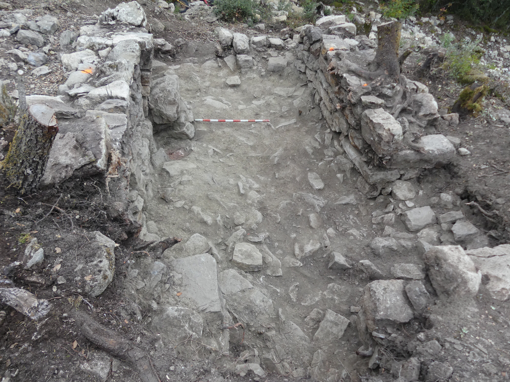
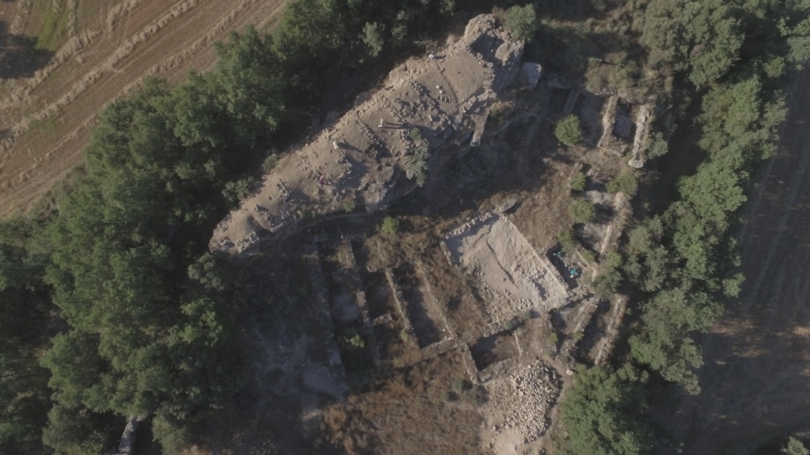
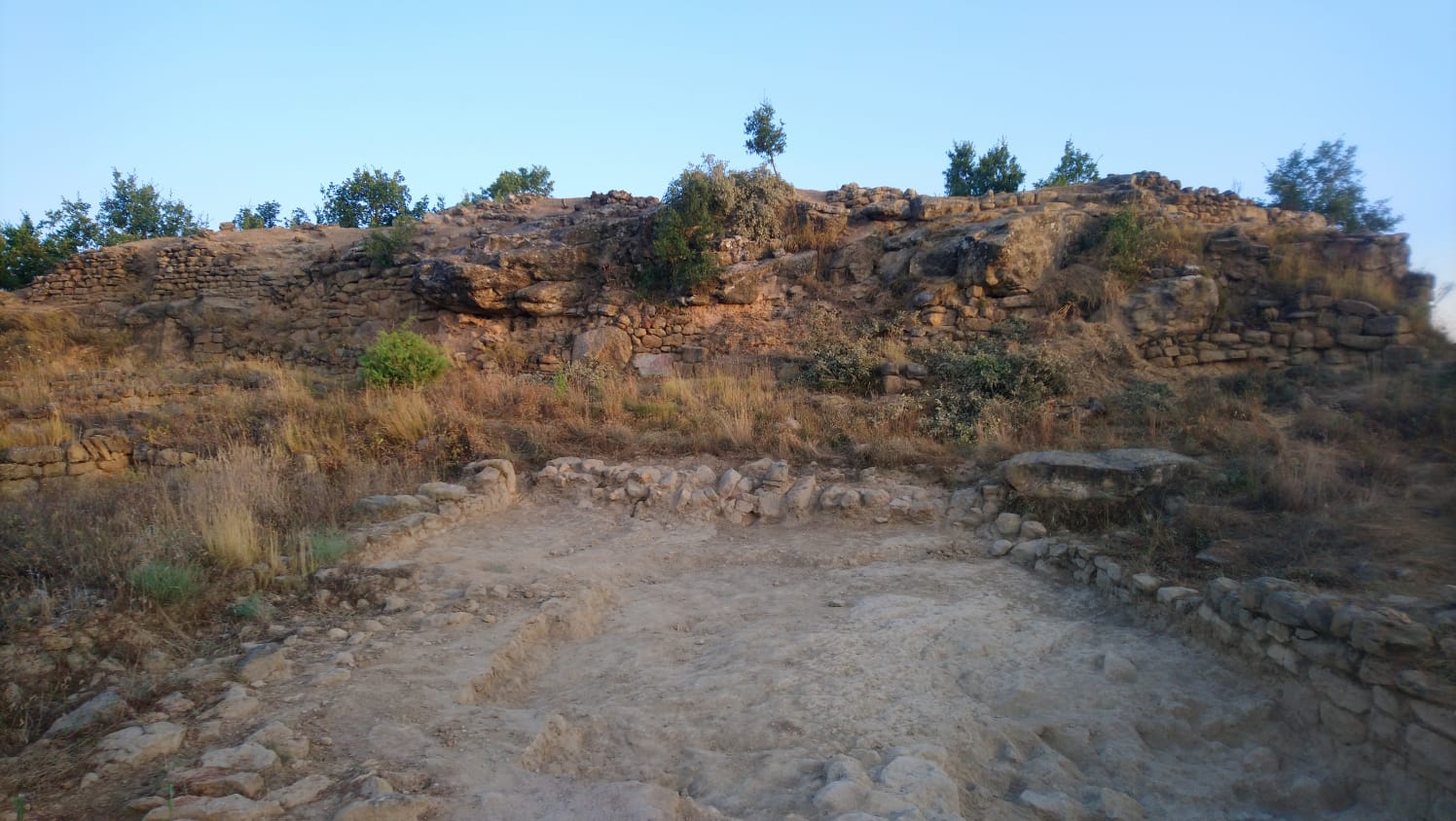
The most extensive has been the survey that we carried out in the vicinity of the Castell de Mur, more specifically next to the cyclopean wall that some authors have considered that it could extend around the entire hill where the castle and the collegiate church of Santa Maria stand. The excavation allowed us to locate various structures related to that wall, which has led us to raise the possibility that, in the space between the castle and the cyclopean wall, following the southern slope of the hill, there was an ancient settlement area. This hypothesis was later reinforced by the results of a geophysical survey carried out in the same place, which showed the existence of walls in different directions that would be in line with those found in the survey.
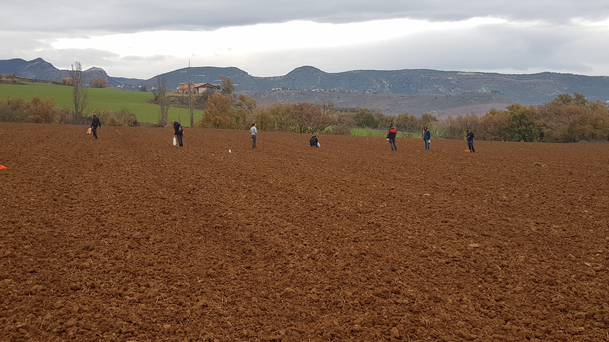
Another prospected area, in this case by means of the systematic collection of surface materials, is the Els Sabarissos area, very close to Talarn. In this case, our interest in the site is due to the fact that it could be the location of the domus Sabarinsse that appears linked to the territorium Orritense in an exceptional document of Saint Victorian of Asan from the 6th century. In fact, this reference would indicate that the extension of that territory, centered on the castle of Orrit, one of the sites in which we have intervened, would extend in ancient times from the Noguera Ribagorçana to the Pallaresa. This is a hypothesis that we can begin to affirm with some certainty, since the results were positive and, although no late-antique materials were found in the specific fields where we concentrated, there is no doubt that in that place there would have been a Roman settlement that, at least, would go from the I to III-IV century A.D. To finish defining the characteristics of this archaeological station, we also conducted a survey with geophysical means in the plots with greater accumulation of ancient materials, whose results are still in the process of study.
Finally, we visually surveyed a site very close to the town of Tremp, where, according to the Archaeological Map, there was evidence of a possible Roman villa, the Vil·la del Camí de Tendrui. However, our collection of materials has given a negative result, so we will have to make a more extensive survey of the area to confirm if it really is a non-existent site or if, on the contrary, there is simply an error in the coordinates included in the Archaeological Chart.