The habitats map of the Creus Cape
This mapping includes all the
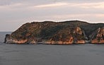
Natural Park of Cap de Creus (except marine reserves), located in the Alt Empordà region. The total mapped area is 10,744 hectares in the municipalities of Cadaqués, Port de la Selva, Roses, Pau, Palau-Saverdera, Vilajuïga and Llançà.
The mapping was done using the ortophotomaps (1:5,000 and 1:2,500) of the
Cartographic Institute of Catalonia (infrared and colour) and the fieldwork was conducted in Spring and Summer of
2009,
2010 and
2011. The legend consists of CORINE units cited and explained in the
Catalan Habitats Manual. The cartographic information is structured in two layers, one of polygons and another of points. Each of which, contains the information of the CORINE habitats and the European Union Habitats of Interest (HCI). The minimum area has been set to 0.2 hectares for polygons (except islets and rock stacks). Habitats which occupy less surface are represented as points. In the whole Natural Park we could create 3,020 polygons and 941 points. In total, 124 habitats were detected; 28 of those are European Union Habitats of Interest (HCI), and 5 of those are priority.
Author: Aaron Pérez-Haase.
Implementation period: 2009 to 2011.
Delivery Date: 2011.
Download maps (ETRS89)
[
SHAPE]