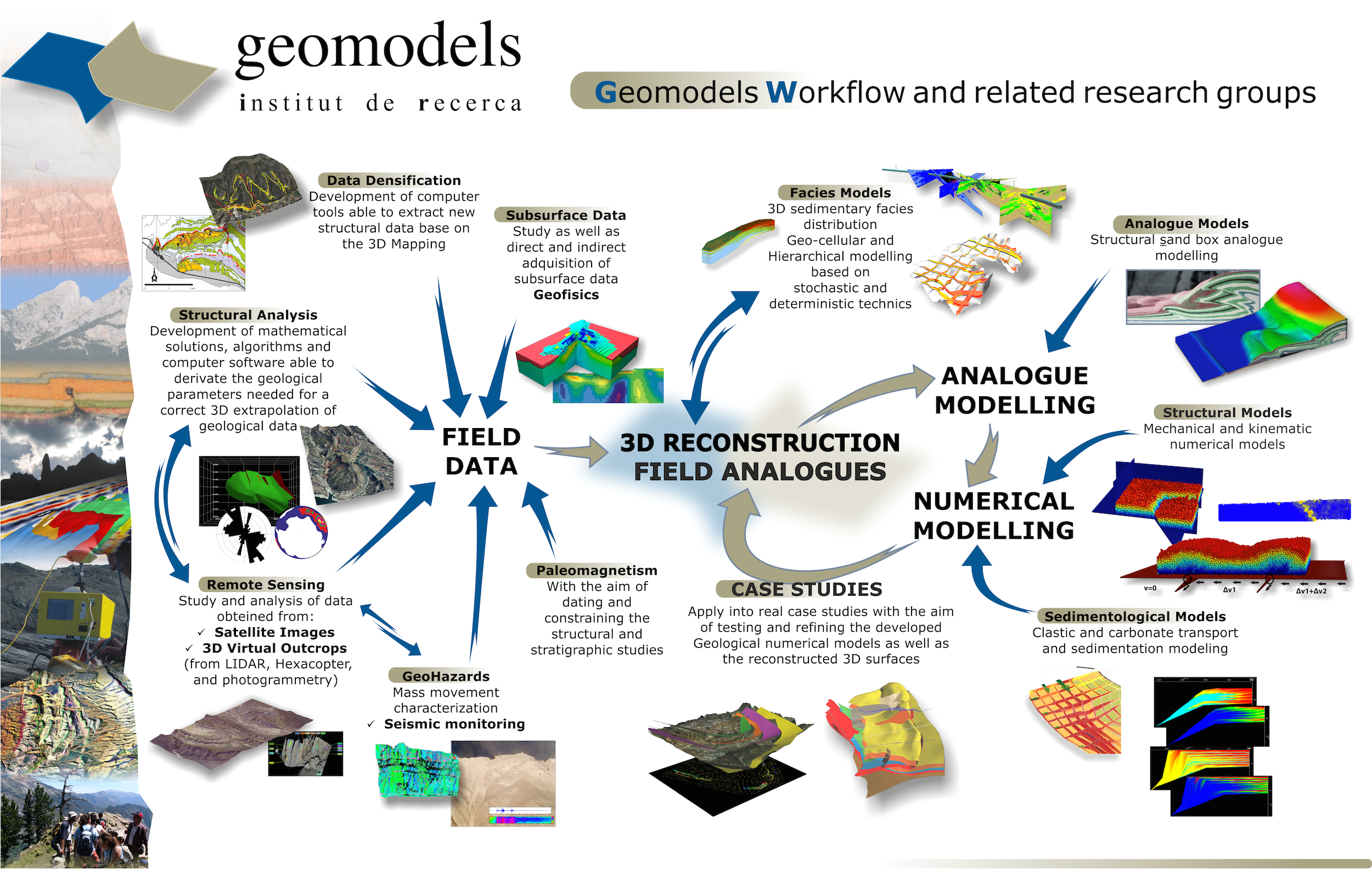
The main goal of the GEOMODELS Research Institute is the development and incorporation of new technologies to the Earth Sciences research area. More specifically, create new modelling techniques to characterize and correctly understand geological systems in terms of: generation, placement and quality of geologic resources and reservoirs; the geo-mechanical terrain behaviour; and natural hazards and their impact on the surface.
A multidisciplinary team has been established aiming to model geological processes in order to improve their quantification and the prediction of related phenomena in space and time. More specifically, we are dealing with 3D characterization of geological bodies, the numerical simulation of processes within these bodies and the use of the resultant 3D models to tackle hazard scenarios.
The GEOMODELS Research Institute is a multidisciplinary research centre assembling geological and engineering methodologies. The results are scientific (improve the knowledge and characterization of geological processes) and technologic (develop new methodologies and modelling tools).
The main research lines are: